November Rain
Until very recently, the most critical factor for human existence on St. John was water: How to collect it, how to save it, how to move it to where you needed it…
These days, all that’s required is a cistern, and a few hundred dollars, and you can truck in hundreds of gallons of desalinated seawater to almost any location on the island. Although anyone concerned about their “carbon footprint” (or their wallet), certainly needs to still be a water conservationist here, the rental–villa business relies enormously on WAPA, and the printed requests to conserve water disappeared from Caneel Bay’s bathrooms about 25 years ago.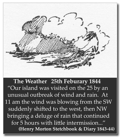 Throughout island history, water has equated to rainfall, and our rainfall is strongly variable. Although there are persistent rumors that the Virgin Islands climate was wetter at some vaguely defined time in the past, this seems very unlikely, though certainly there were always periods, some as long as a decade or so, of higher rainfall —we are in one now, with the past 5 years in a row all above average. Just as surely, there have always been severe droughts, and these can be more destructive to plant and animal life than hurricanes.It is likely that the original forests of the island caught and held the rainwater much more efficiently than is the case today. A ground layer of organic debris that has been undisturbed for millennia can’t help but be absorbent. Because of this, it’s probable that most of the larger guts flowed almost all the time…not rushing, but trickling and clear. We can still get a sense of this when there’s enough rain to recharge the high central aquifer between Margaret Hill and Mammey Peak; the guts of the north shore may run for months— or even years, as occurred in the late 1960’s.The first task undertaken by the group who came from St. Thomas to Coral Bay in 1718 was to dig a well, in the flat of Carolina Valley; but even in the early 18th century, local groundwater may have been less than ideal. J.L. Carstans, a Creole native of St. Thomas, writing of that time period, said: “During prolonged droughts, these guts may dry up and disappear. On these occasions the local inhabitants resort to wells, locally called “pytter” which are located by their houses; there are many others, as well as some along the bays. These wells have been dug out of the earth, and are made of brick. The water in them is brackish because they have been fed by the sea.”Carstans also wrote of the importation of water from Vieques to St. Thomas (which had its modern parallel during the years before R/O plants in the Virgin Islands: Cruz Bay dock in the 1960’s and 70’s was dwarfed every few weeks by the enormous water barge from Puerto Rico that seemed destined to crush every boat in the harbor, as well as the dock itself). Carstans described water shipped in casks from Vieques. During the drought of 1737, it sold for 12 Danish skillings per bucketful on St. Thomas; elsewhere he equates the value of a quart of water during that drought to the value of a quart of beer or wine.By the 19th century we get a lot of real weather data being recorded in the islands, and see patterns identical to those we’re familiar with today. Pastor John Knox of the Dutch Reformed Church included a whole chapter on climate in his Historical Account of St. Thomas, W.I. published in 1852. To the modern eye, it seems odd that almost half of the chapter is devoted to invalids, disease and burial, but it was still decades before the official connection was made between mosquitoes and malaria, yellow fever, and dengue, all of which were endemic in the islands. Without knowledge of that connection, it was no wonder that rain, moisture–and exposure to night air— were considered risky to life itself.At the beginning of the 20th century, the shift from plantation crops to cattle ranching on St. John probably re–activated many old wells that had been too brackish for human or plant use, since cattle have a tolerance for salt greater than many other species of land life.Government dollars built hillside catchments and community cisterns on all three islands…often a long hard walk with heavy buckets from people’s houses, but immensely helpful for the many small dwellings that relied on barrels for water storage.In the 1950’s, Caneel Bay began experimenting with primitive desalinization by evaporation, an activity overseen by Gus Stark, one of the island’s early American residents, who worked at Caneel from the pre–Rockefeller days up into the 1960’s. Laurance Rockefeller later gave financial backing to Israeli scientists working with new reverse osmosis techniques–the challenges of running Caneel and Little Dix with inconsistent water supplies must have been immense.Rainfall records have been kept on St. John for varying lengths of time for various locations, longest at Cruz Bay, where records apparently began in the mid-1800’s.Dr. Bernie Kemp, while doing research in Copenhagen a dozen years ago, found beautifully written weather records from the Battery in Cruz Bay in the 1860’s. Rainfall was noted in mysterious increments of 1/8 of an “English inch”, but once converted, the monthly totals look very predictable from our modern averages.Caneel Bay kept continual records from 1955 to 1998, and those 43 years give us a great snapshot of St. John patterns. On average, at 48.56 inches, Caneel appears to get an inch or two more than Cruz Bay each year, although we’re all familiar with how localized rain can be, with one bay’s roadsides filled with rushing torrents while the next bakes in the afternoon sun. During those 43 years, February and March were tied for the position of driest month of the year at Caneel, with a total of under a tenth of one inch possible in either month, and just over two inches as the average (March wins by having more days in which rain could have fallen). Sometime in late April or May, in many years, the drought would break with a major rain, pushing April’s average to 3.36 inches, and May’s all the way to 5.11 inces. May was the month with the greatest variability, with under two inches in nine of those years, and over six inches in another nine— and over twelve inches five times! June would then be drier, back down to a 3.5 inch average, but then it would get steadily wetter up to November, with its whopping 6.11 inch average…Although there were still 5 years out of 43 with under 2 inches for the month, there were 16 Novembers with over 6 inches. December could stay rather damp, with a 4.28 inch average; and January might be muddy, even with its low 2.76 inch average, especially with the weaker winter sun and the autumn’s accumulation in the soil.St. John’s wettest and driest years of the 20th century occurred during those 43 years.The memorable year 1979 holds the record for rain at Caneel: 75.11 inches! Over 14 inches fell in May that year, and then the passage of Hurricanes David and Fredrick to the south of the island in September added more than 16 inches, and then there was a 11.55 inch November…
 In contrast, 1994, apparently the driest year of the century, was approximately a third of that amount, at 26.11 inches. The drought continued until a month or so before Hurricane Marilyn, in the summer of 1995, and there was widespread devastation, including the deaths of the famous silk cotton tree at Cinnamon Bay, and many mangroves in land-locked pond areas around the island. The salt in the soil concentrated as the soil dried, and pulled moisture out of the roots of the trees.The greatest single– day event record was the memorable flood of April 17–18th 1983, when some parts of the island got over 18 inches between 9 at night and 10:30 the next morning. The most intense rain on record was the 3.4 inches per hour that fell toward the middle of that night. Caneel’s official total for the flood was 17.05 inches, but the relief weather recorder who took the measurement confessed that his hand had been shaking while pouring the “overflow” outer rain-gauge contents repeatedly into the inner 3-inch measure. Damage in St. Thomas/ St. John were estimated at $12.5 million, and one person died in St. Thomas.As concerns have grown over the effects of silt and mud from hillside construction on the coral reefs of the region, the joyful thrill many residents had when the guts filled and rushed to the sea has been dimmed by knowledge of the damage being caused. To help counter this somewhat, recent research has shown that the high seawater temperatures that cause coral bleaching in the summer are dramatically lowered by our autumn rains. The bigger the rain, the quicker and greater the decrease in water temperatures, hastening the potential recovery of the coral.The one certainty may be that we’ll have serious drought again, and severely damaging rainfalls, and luckily, sometime, have five years in a row again like these last five, without either one or the other.